Menu

Navigation

The Mediterranean expanse, which in antiquity was defined as “The Great Sea”, has for centuries drawn mariners, conquerors and commerce-minded peoples into its various waterways. Navigational instruments have always had an indispensable role, particularly once navigators were no longer content merely skirting coastlines. Little is perhaps in common between the Phoenician seafarer, the British submarine captain or the refugee at a glance, bar for the solar wheel, compass, sextant or smartphone in their hand: companions outlining the common purpose of humanity in these azure waters: a search with a clear end in sight, be it for prosperity, prize or even merely life.

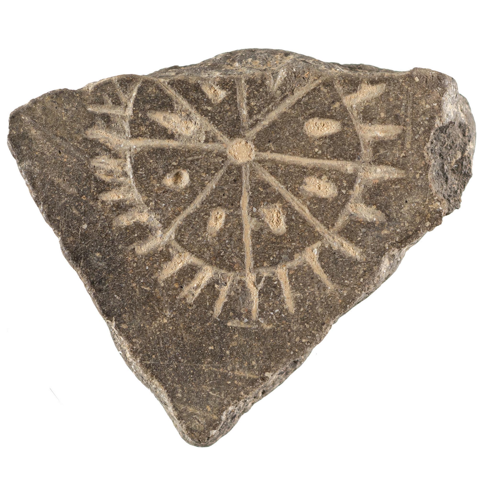
Individually, each object from this selection presents stages of innovation, starting from an inscribed sherd and ending with an all-too recognisable platform for a Global Positioning System (GPS), each respective object more capable than the previous. Collectively, they represent the island’s perpetual flaw and blessing: an isolated Malta, a connected Malta.

ArtEfacts

Size

0.7 x 3 x 2.9cm

Date

3800 - 2500 BCE

Location

Malta Maritime Museum, Ground Floor

Reference Code

Q/P 55

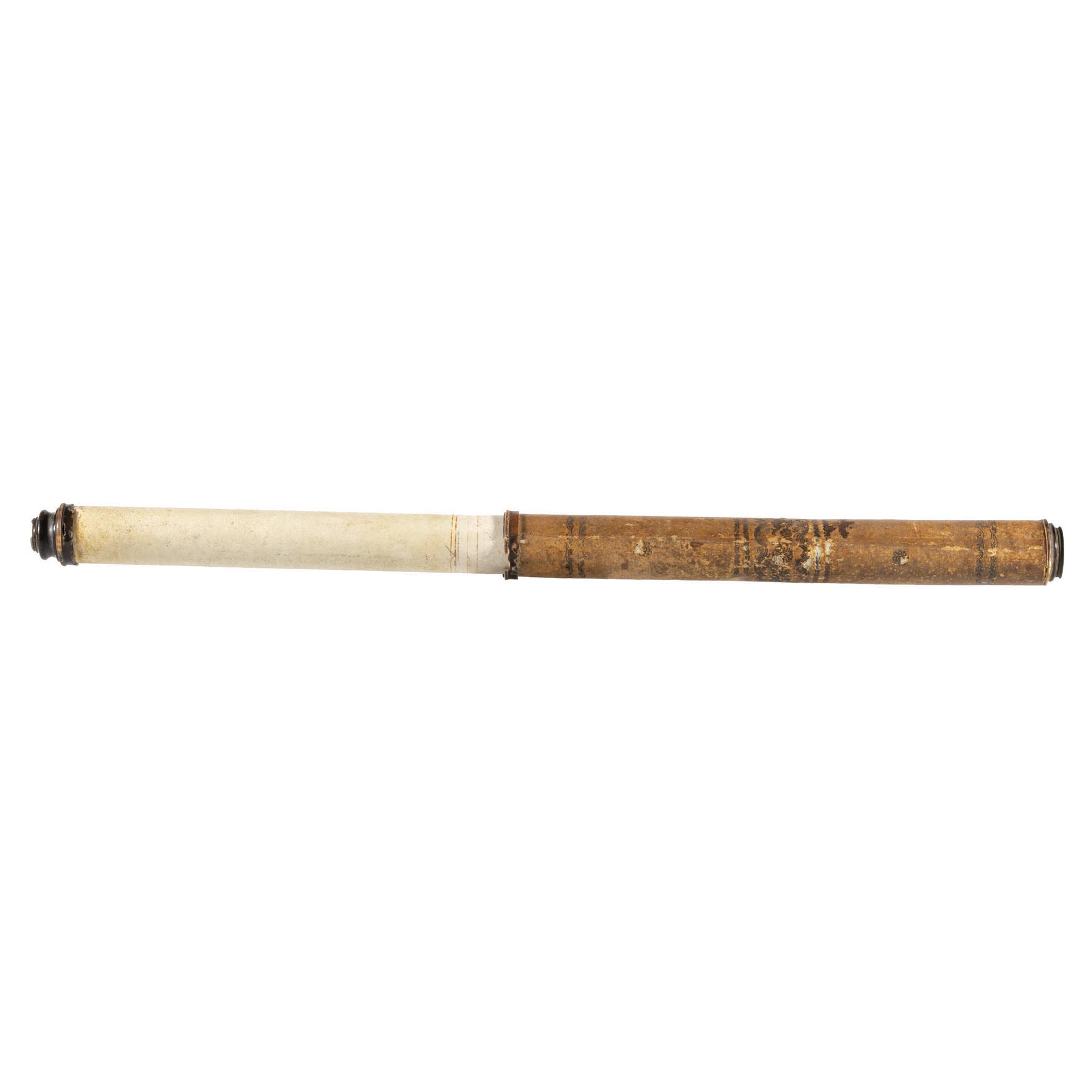
Size

67.5cm x 4.5cm (open)

Date

1740-1760

Location

Malta Maritime Museum, Ground Floor

Material

Metal, paper, parchment, turtle

Reference Code

MMM 004557

Mid 18th century card bodied refracting Telescope covered with parchment decorated with flowers; eye-piece missing; includes rings made of turtle.

Size

17.7cm x 28.3cm x 28cm

Date

1941

Location

Malta Maritime Museum, Ground Floor

Creator

Karl Heinrich Christian Plath

Reference Code

MMM 004620.9

Black Trommel sextant dated 1941 marked with the German Nazi Eagle symbol and swastika over Runic M, [Kriegsmarine “M”] and the number “3831”. Marked with the producer name “C. Plath Hamburg”. Includes the D.S. stamp on the left side of the arc and the serial number 18872 on the right side.

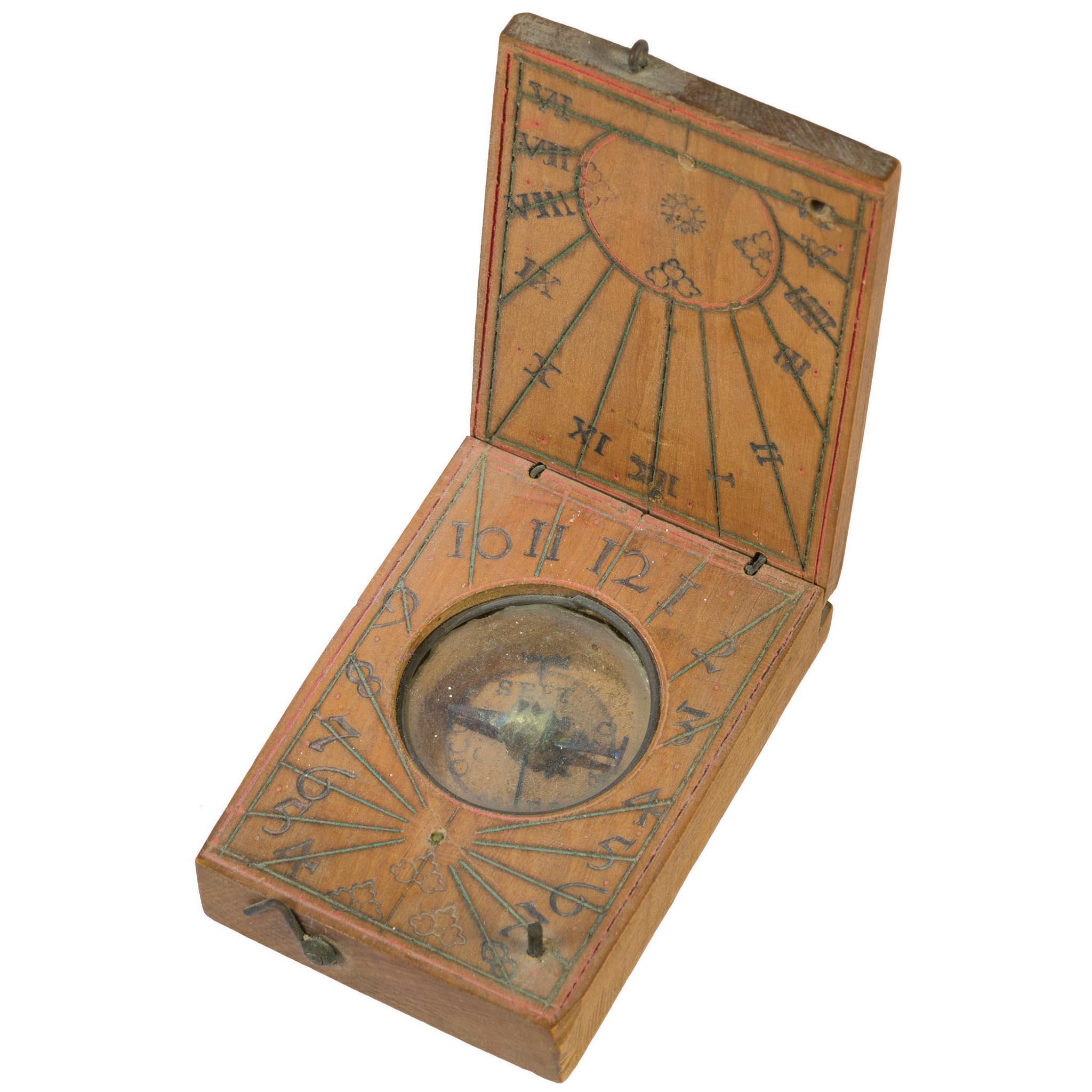
Size

7cm x 6.4cm x 4.8cm

Date

1785-1790

Location

Malta Maritime Museum, Ground Floor

Material

Wood; Hand coloured on paper

Reference Code

MMM 001187

A finely decorated 18th century Diptych Sundial and Compass in a portable wooden boxwood, with string gnomon, possibly of German origin. Similar compasses were attributed to Johann Georg Kleininger of Nuremberg, dating back to circa 1785- 1790. This miniature diptych dial consists of two leaves that fold flat when not in use. Leaf 1 exterior contains a deteriorated inscription which unfortunately is not legible. Leaf 1 interior contains the vertical dial with hour lines radiating from a central decorative motif. This leaf is decorated with borders and hand-painted grapes. Leaf 2 interior has the dial, where the cardinal points are possibly marked in German. The dial is surrounded by hour references. Both clock and leaf are surrounded by a decorative border, with hand-painted floral and vegetal motifs, namely two sunflowers. Leaf 2 exterior is blank. The leaves have a brass hook fastner.

Size

5.5cm x 3.8cm x 5.1cm

Date

1700-1770

Location

Malta Maritime Museum, Ground Floor

Material

Boxwood

Creator

Leonhard Andreas Karner

Reference Code

MMM 001188

A miniature Diptych dial for 49° North. It consists of two leaves that fold flat when not in use. Leaf 1 exterior is blank except for a double-lined border. Leaf 1 interior contains the vertical dial with hour-lines radiating from a double circle. Within the circle are five trefoil motifs and a snowflake motif. The leaf has a double-lined border. Leaf 2 interior features the compass with the hours for the horizontal dial set around it. The string gnomon is broken.

The compass has the cardinal points marked in Latin and is offset 20° West of North to allow for magnetic variation. There is a fleur-de-lys on the right-hand side of the compass and a makers mark – a hand which appears on the left-hand side of the compass. At the bottom of the leaf are three trefoil motifs and a double-lined border. A brass pin for keeping the leaves aligned when closed is on the bottom right. Leaf 2 exterior is blank. The leaves have a brass hook fastener and a single brass hook for holding the dial open.

Captured and used by the Royal Navy

Size

28.3 x 17.7 x 28cm

Date

Mid-20th century

Material

Wood, metal

Reference Code

MMM 004620.9

Size

14.8 x 9cm

Date

1574

Material

Brass

Reference Code

MMM 000069

Size

7.7 x 4.6cm

Date

17th century

Material

Wood; Card, glass and wax

Reference Code

MMM 000065.2

Size

Compass: 75mm x 35mm x 46mm (overall height)Lid: 77mm x 11mm

Date

1600-1699

Location

Malta Maritime Museum, Ground Floor

Reference Code

MMM 000065.2

Mariner’s compass composed of two parts – the compass itself inside the boxwood case and the lid. It may be a Portuguese invention but requires further research. This small compass is mounted in a turned wooden box. The card is probably hand-painted and is marked with the 32 points. The north point is decorated and the east point with a cross indicating Jerusalem. The other cardinal and semi-cardinal points are marked G, L, S, O, P and M.

Size

14.8cm x 9cm

Date

1574

Location

Malta Maritime Museum, Ground Floor

Reference Code

MMM 000069

The nocturnal is an astrolabe for telling time at night or for determining latitude by the position of the stars in relation to Polaris (Alpha Ursae Minoris). Time could be read at time thanks to this instrument by observing the position of the brightest star in the constellation of Urs Minor, commonly known as the North of Pole star. Polaris includes the main star (Polaris Aa) in orbit with a smaller companion (Polaris Ab). Polaris B was discovered in 1780 by William Herschel long after the nocturnal on display in this exhibition and its purpose became obsolete with the introduction of the marine chronometer in the 1760s.

The earliest known image of a nocturnal can be traced back to a twelfth-century manuscript. Cosmographicus Liber (1530) by Peter Apianus and Martín Cortés de Albacars Arte de Navegar (1551) also feature interesting examples of nocturnals. Nocturals were made either of brass or of wood. Examples found in wreck excavations have augmented the already known examples. Surviving noteworthy exemplars include the brass version by the Florentine Girolamo della Volpaia in the Museo Galileo (Florence) dated 1568, formerly in the Medici Collection, and an almost intact version in wood at the National Maritime Museum (Greenwich), which is probably of French manufacture and dates to 1588.

The Malta Maritime Museum exemplar, here displayed and being published for the first time in this exhibition catalogue, is one of a very small group of nocturnals or near-complete versions conserved in museums worldwide given that the only missing pieces are its suspension loop and sundial gnomon. The example features a series of disks, known as volvelle, mounted on and held together by a bolt and three ray nut attached to a main disk and handle. The only missing component is the suspension loop. The bolt-and-nut attachment is more common in the assembly of astrolabes, and this makes this example even the more a rare example.

Nocturnals should not be confused with astrolabes used by navigators to determine local latitude at a given position at sea or land. The obverse side features four divisions of 90° each on the main disk with a slide chart or volvelle, marked in the centre with two sets of sundial hour lines, from 1 to 12, marked as Hora ante Meridiem and Hora post M(e)ridiem. This is also known as the Tabula Solis Motus or ‘table of the sun’s motion’ and would show the mark of the sun’s rays on the 12 zodiac signs at the outer edge of this volvelle. When unbolted and turned around, an engraved three sided square-like scale of as-yet-undetermined use can be seen on this volvelle.

The reverse side of the instrument is the nocturnal mechanism proper. The zodiac scale is engraved on the outermost edge of the main disc with the 12 zodiac signs, complete with their symbols and Latin names in full, inserted in between a series of sub-divisions in degrees adding to 360°. The months of the Julian calendar are engraved further in, again with their Latin names inscribed in full. The date scale is divided into three ten-day sections per month. A toothed rotatable disk, the volvelle, is subdivided into two sets of anti-clockwise 12-hour markers, each tooth marking the full hour. Each hour is subdivided by four quarter-hour marks with a longer tooted pointer at 12 hours (midnight) engraved with the word “Index. An arm rotating over it, marked by the engraved words Stella Obseruanda, is interspaced with a hole representing the bright star showing off engraved rays. The circular pivot of this arm is also engraved with the words Stella Polaris and the date 1574.

The correct function of this instrument is still elusive but we can presume how it worked. In order to read the time correctly, the nocturnal would be held from its handle, much like a hand-mirror, with the disks above the user’s hands. The correct date was set, and the Polar Star sighted through the index arm observation hole. The correct time was set at the point when the arm crossed the marked disk.

THE FUTURE?

Still at the crossroads, as the European Union’s southernmost frontier in the Central Mediterranean, Malta

TOURISM AND LEISURE

In medieval times, travelling was either limited to the wealthy classes, or done for religious

WE’RE GONNA NEED A BIGGER BOAT! – FISHING IN MALTA

Coastal resources have been used by mankind globally as means of economic and social development

1979: THE END OF AN ERA

The year 1979 is an important milestone in Maltese history when Britain’s military connection to

THE SECOND WORLD WAR

During the Second World War, Malta played a vital role in the Battle for the

THE ADMIRALTY DOCKYARD – THE INDUSTRIAL AGE

During the Industrial Revolution, the Royal Navy invested in Malta, building an Admiralty Dockyard and

GOLDEN AGE OF SAIL – SHIPBUILDING IN MALTA

The 19th century was the pinnacle of Maltese shipbuilding, building vessels to import material such

PATRIA LIBERATA – THE FRENCH BLOCKADE

With war in Europe spreading like wildfire, France became embroiled in a war across the

FOREIGN > LOVE AFFAIRS

By the summer of 1798, Britain and France were locked in an epic struggle which

LIBERTÉ, ÉGALITÉ, FRATERNITÉ – THE FRENCH IN MALTA

Malta in 1798 went into shock. The once overlords of the island principality were overrun

PRINCIPALITY BY CORSAIRS FOR CORSAIRS

Prior to the arrival of the Order of St John in 1530, many Maltese noblemen

LEPANTO: A FINAL CLASH?

The Holy League of 1571 was not the first to band Christian forces against the

POMP, WAR AND CEREMONY

The rambata, a distinctive feature of Mediterranean galleys between the 16th and 18th centuries, represented

1565 – THE GREAT SIEGE

An island at a crossroads will eventually become involved in major conflict, and in the

SUSTAINABILITY, RECYCLING AND THE ECONOMY

The limited locally available resources of the Maltese Islands, and their huge dependency on Sicily,

ST PAUL: FATHER OF THE MALTESE NATION?

When a Moorish army broke the siege of Mdina for winter in September 1429, the